Our Services
Ensure your journey to your dream home is seamless and bespoke by booking an appointment with our elite property consultants, who are dedicated to providing you with unparalleled service and expertise at every step.
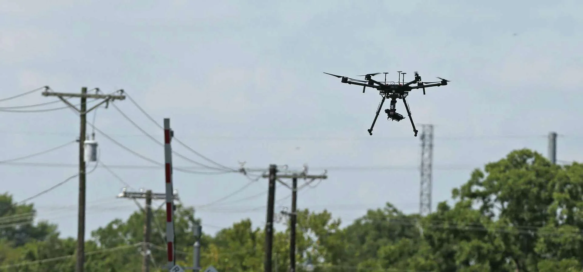
Surveying and Mapping
Unlock precise, high-resolution aerial mapping with our cutting-edge drone technology. We provide accurate georeferenced imagery and topographic maps for land surveying, construction, and urban planning. Our drone-based mapping reduces fieldwork time, enhances decision-making, and delivers cost-effective, real-time data. Whether you need detailed orthomosaics, contour maps, or site analysis, our services ensure precision and efficiency. Elevate your projects with our expert aerial mapping solutions.
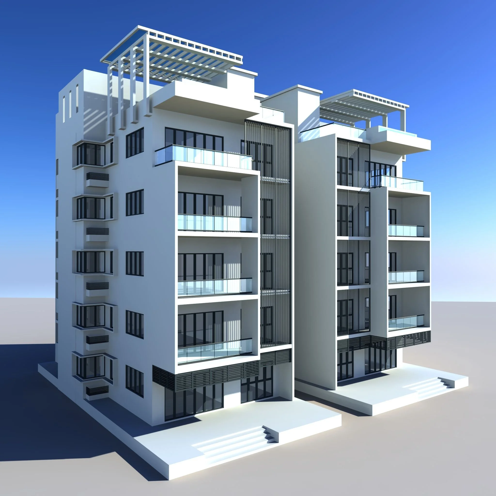
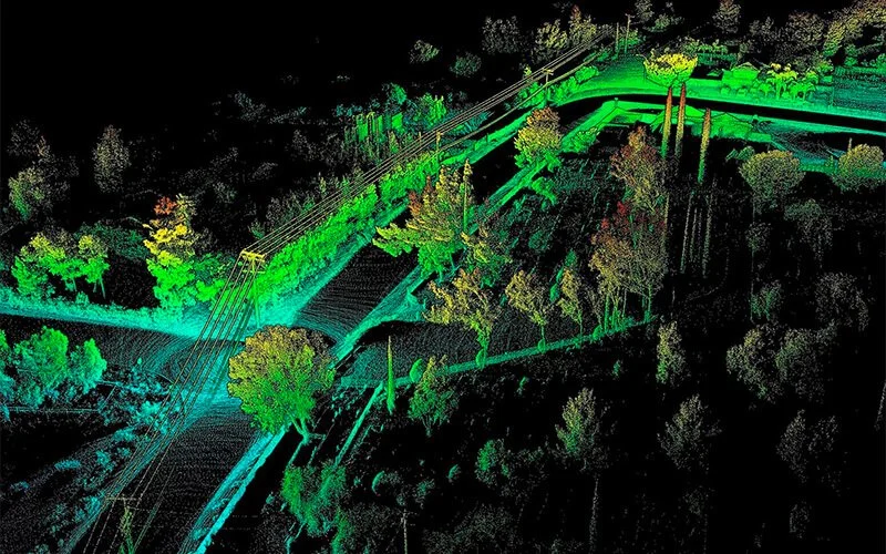
3d Modelling
Bring your projects to life with our high-accuracy drone-based 3D modeling. We create detailed digital twins of landscapes, buildings, and infrastructure using advanced photogrammetry and LiDAR. Perfect for construction planning, real estate visualization, and industrial site analysis, our models provide unparalleled insights and precision. Reduce costs, improve efficiency, and make data-driven decisions with our professional 3D modeling services. Let us transform your vision into reality.
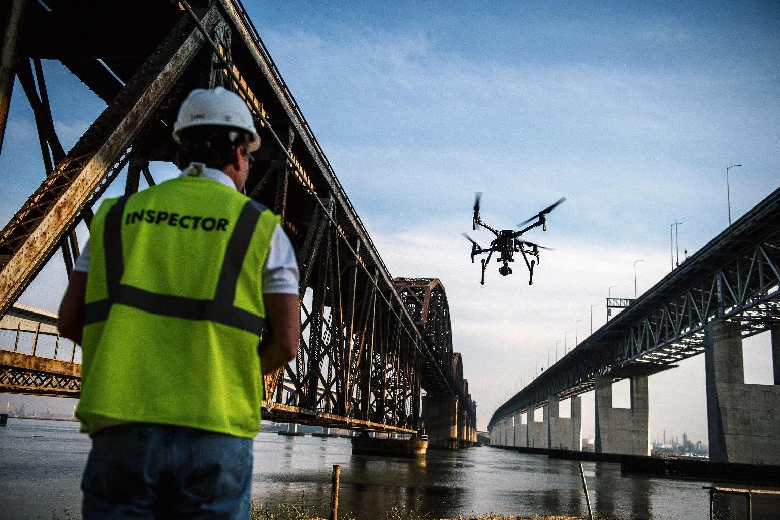
Aerial Inspection & Analysis
Enhance safety and efficiency with our expert drone-based aerial inspection services. We provide high-resolution imagery and thermal analysis for power lines, bridges, pipelines, wind turbines, and industrial assets. Our inspections detect defects, corrosion, and structural weaknesses—reducing downtime and ensuring compliance. With fast, cost-effective, and detailed reporting, we help you stay ahead of maintenance issues. Minimize risks and maximize operational efficiency with our cutting-edge aerial inspection services.